Geospatial · LLM tools
GeoMCP
A satellite-analysis API that both apps and AI agents can use, via REST and Model Context Protocol.
What it is
GeoMCP lets regular apps and AI agents analyze satellite imagery: vegetation health, water, terrain, land cover and change over time. It speaks plain REST for apps and GIS tools, and the Model Context Protocol (MCP) so LLMs like Claude can call it directly.
53REST endpoints
37MCP tools
8spectral indices
3output formats: PNG, GeoTIFF, JSON
What it can do
- Spectral indices: NDVI, NDWI, NDBI, NDMI, EVI, NDRE, MSAVI, NBR.
- Terrain: elevation, slope, aspect, hillshade, and D8 hydrological flow accumulation written in pure NumPy.
- Land-cover classification: rule-based, K-Means and Random Forest.
- Zonal statistics, point and area time series, cloud masking and compositing.
A neat trick
Raster results can be huge (a 512×512 matrix is over a megabyte of text), which would flood an LLM’s context window. GeoMCP writes big matrices to disk as .npy files and hands the agent a file reference plus summary stats instead.
Architecture
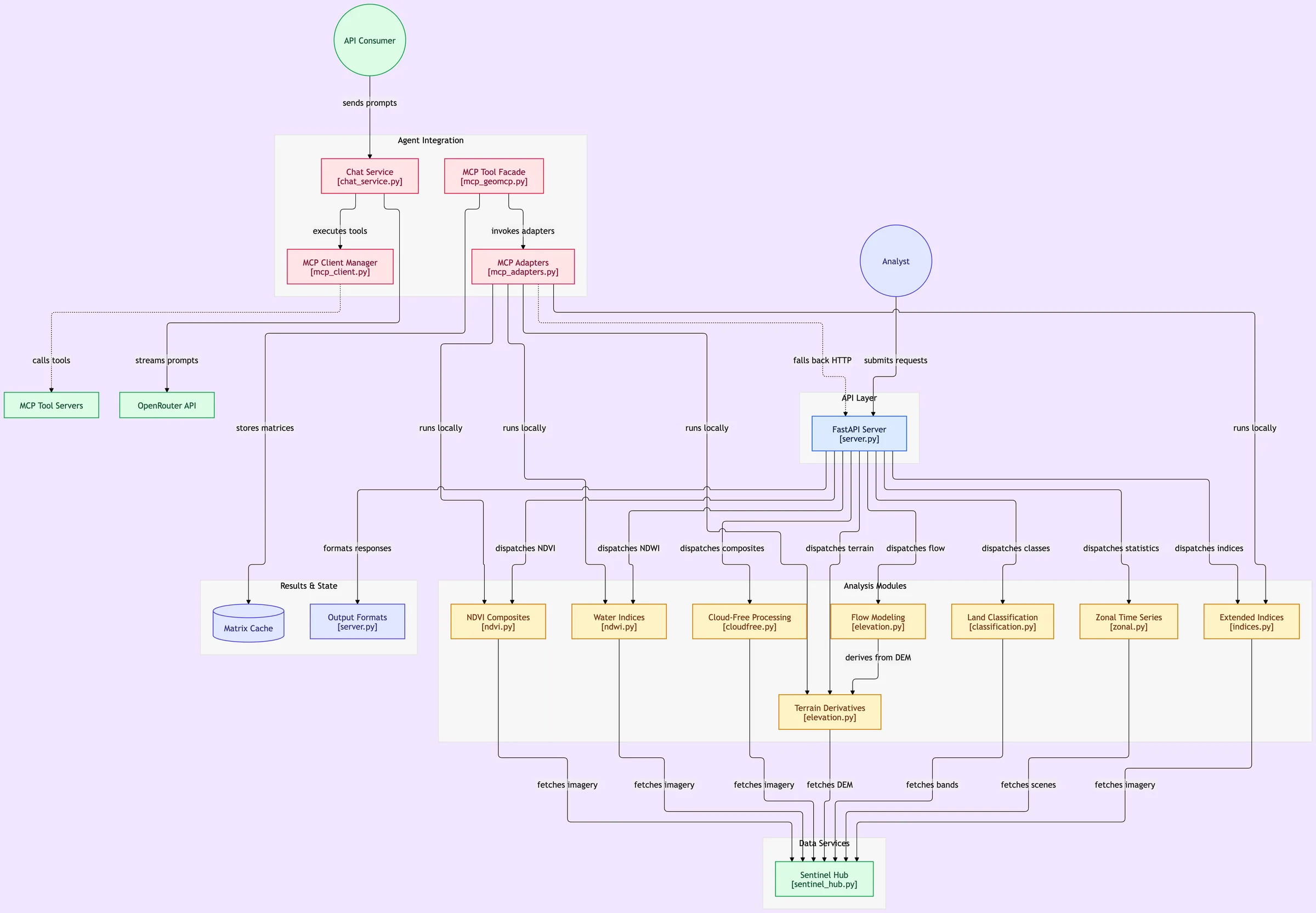
- FastAPI server and a FastMCP server sharing the same processing modules, with a hybrid adapter that runs in-process or falls back to HTTP.
- A streaming chat orchestrator (OpenRouter) that runs multi-turn tool calls.
- Data from ESA Sentinel-2 via Sentinel Hub (OAuth2 with token caching), SRTM elevation, and Global Human Modification via Google Earth Engine.